Get Expert GIS Database Support Services, Health Assessment & Consultation
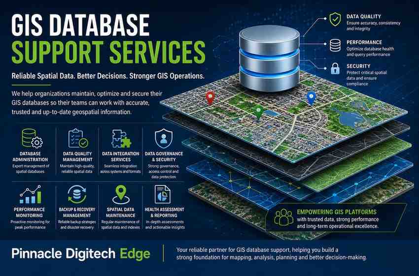
GIS Database Support Services
When GIS Problems Are Not Really Mapping Problems
Most organizations assume that GIS failures start on the map.
- A layer loads slowly.
- A parcel boundary disappears.
- A search takes forever to return results.
- An infrastructure dashboard stops responding.
- A user reports that the system is timing out.
The immediate reaction is often to investigate the GIS application itself.
- Teams look at map services.
- They review user permissions.
- They restart application servers.
- They inspect network connectivity.
Yet in many cases, the real issue sits much deeper.
visit community mapping platform for details
The database behind the GIS platform is struggling.
At Pinnacle Digitech Edge, we have seen this pattern repeatedly across land management systems, utility networks, smart city initiatives, infrastructure projects, and enterprise GIS deployments. The visible symptom appears on the map, but the root cause often originates inside the geospatial database supporting that map.
A GIS platform is only as reliable as the database underneath it. When spatial data becomes fragmented, poorly maintained, inconsistent, or difficult to access, the entire GIS ecosystem begins to suffer.
That is where GIS Database Support Services become essential.
Why GIS Databases Become Difficult to Manage
GIS databases are fundamentally different from traditional business databases.
- A financial application may manage transactions.
- A CRM system may manage customer records.
- A GIS platform manages geography itself.
Every road segment, utility line, building footprint, land parcel, zoning boundary, infrastructure asset, and administrative region exists as spatial information inside the database.
Over time, these datasets become increasingly complex.
- New projects are added.
- Historical records accumulate.
- Multiple departments contribute data.
- External agencies provide updates.
- Satellite imagery is integrated.
- Survey information is imported.
- Asset inventories expand.
Without a structured support framework, the database gradually becomes harder to manage and maintain.
The issue is rarely a single event.
It is usually years of growth without corresponding governance.
The Hidden Cost of Poor GIS Database Management
Organizations often focus on acquiring GIS software while overlooking database health.
Initially, the impact appears small.
- Map layers take a few extra seconds to load.
- Data updates require additional effort.
- Users occasionally encounter inconsistencies.
- Eventually the situation becomes more serious.
- Project teams begin making decisions based on outdated information.
- Infrastructure planning becomes less reliable.
- Asset inventories lose accuracy.
- Departments start maintaining separate copies of datasets because they no longer trust central repositories.
The result is duplication, confusion, and operational inefficiency.
A GIS database should function as a trusted source of truth. When confidence in that data erodes, the value of the entire GIS investment begins to decline.
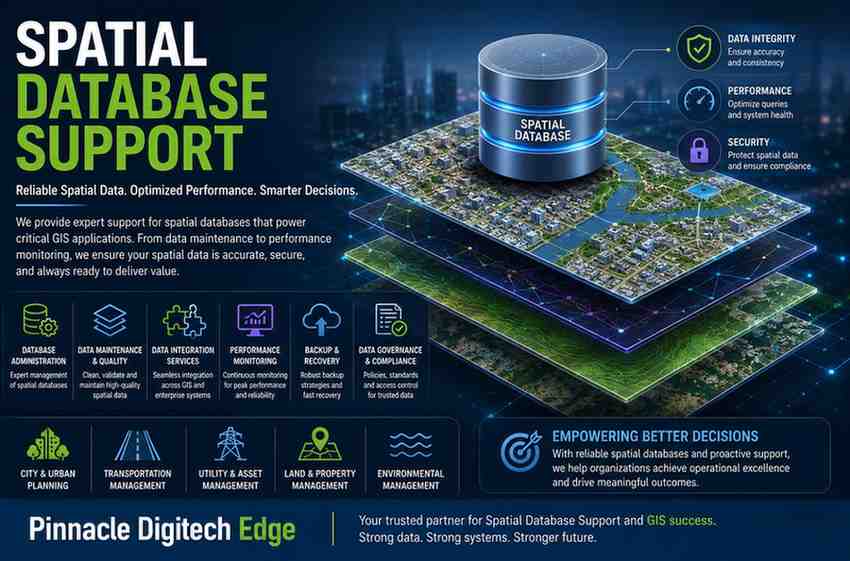
Supporting Enterprise GIS Environments
Enterprise GIS environments contain far more than maps.
They support planning decisions, operational workflows, regulatory compliance, infrastructure management, and strategic investments.
For a municipal authority, GIS databases may contain property ownership records, zoning boundaries, transportation networks, drainage systems, and utility corridors.
For a real estate developer, they may support land acquisition, master planning, project tracking, and infrastructure development.
For utility companies, GIS databases often represent critical operational assets that field teams rely on every day.
Each of these environments requires continuous monitoring, maintenance, validation, and administration.
Without dedicated GIS database support, small issues can quickly grow into major operational challenges.
Data Quality Is the Foundation of GIS Success
One of the most overlooked aspects of GIS management is data quality.
Maps can appear visually correct while underlying data contains serious issues.
- Duplicate records may exist.
- Spatial relationships may be broken.
- Attributes may be incomplete.
- Coordinate systems may be inconsistent.
- Topology rules may be violated.
- The consequences are significant.
- Analysis becomes unreliable.
- Reports become inaccurate.
- Planning decisions become riskier.
Our GIS Database Support Services focus heavily on maintaining data integrity because reliable spatial analysis depends on reliable spatial data.
When data quality improves, confidence across the organization improves as well.
GIS Database Administration Beyond Routine Maintenance
Many organizations treat GIS database administration as a simple maintenance activity.
In reality, effective administration requires a proactive approach.
- Database growth must be monitored.
- Storage requirements must be anticipated.
- Data standards must be enforced.
- Backup strategies must be validated.
- Security controls must be reviewed.
- Integration processes must be managed.
A GIS database that receives proper administrative oversight remains stable even as data volumes increase and business requirements evolve.
This proactive model prevents problems instead of merely reacting to them.
GIS Data Integration Challenges
Modern GIS platforms rarely operate in isolation.
They exchange information with ERP systems, asset management applications, planning platforms, field mobility solutions, and business intelligence tools.
While integration creates value, it also introduces complexity.
- Data formats differ.
- Update frequencies vary.
- Validation rules may conflict.
- Transformation processes become difficult to maintain.
Over time, synchronization issues begin appearing.
Departments see different versions of the same information.
Reports no longer match operational systems.
Users lose trust in the data.
Comprehensive GIS Database Support Services help organizations maintain consistency across integrated environments while preserving data accuracy and operational continuity.
Supporting GIS Data Governance
Data governance is often discussed but rarely implemented effectively.
As GIS environments grow, governance becomes increasingly important.
Questions begin to emerge.
- Who owns each dataset?
- Who can edit it?
- How are changes approved?
- How is quality validated?
- How are historical versions preserved?
- Without clear governance, spatial databases become difficult to manage.
Strong governance frameworks ensure that GIS information remains accurate, secure, traceable, and trustworthy.
This creates a sustainable foundation for long-term growth.
GIS Database Health Assessments
Many organizations discover database issues only after users report problems.
A healthier approach is periodic assessment.
A GIS Database Health Assessment examines the overall condition of the environment.
- Storage utilization is reviewed.
- Data quality metrics are evaluated.
- Security controls are assessed.
- Integration points are analyzed.
- Administrative processes are validated.
- Performance indicators are examined.
- These assessments identify risks before they become operational incidents.
The result is improved stability, better planning, and reduced business disruption.
GIS Database Support for Land and Property Systems
Land and property platforms rely heavily on accurate spatial information.
- Parcel boundaries.
- Ownership records.
- Development plans.
- Infrastructure networks.
- Administrative boundaries.
- Every decision depends on reliable data.
When database issues occur, planning approvals may be delayed.
- Property assessments may become inaccurate.
- Development projects may encounter unnecessary risk.
Effective GIS database support ensures that land and property systems continue operating with confidence and accuracy.

Why Organizations Choose Pinnacle Digitech Edge
- GIS technology continues to evolve.
- Data volumes continue to grow.
- Business expectations continue to increase.
Organizations need more than software support.
They need a partner capable of understanding the relationship between geospatial data, business processes, infrastructure, governance, and long-term scalability.
At Pinnacle Digitech Edge, we help organizations establish reliable GIS database environments that support operational efficiency, data accuracy, regulatory compliance, and future growth.
Our approach focuses on stability, governance, data quality, integration, administration, and continuous improvement.
The goal is simple.
To ensure that your GIS database remains a trusted foundation for every map, analysis, report, project, and decision built upon it.
Ready to Strengthen Your GIS Database Environment?
If your organization depends on GIS for land management, property development, infrastructure planning, utilities, asset management, or smart city initiatives, now is the time to evaluate the health of your GIS database environment.
Contact Pinnacle Digitech Edge today to schedule a GIS Database Health Assessment and discover opportunities to improve reliability, data quality, governance, and operational performance across your geospatial ecosystem.
Our other services Other